-

Both the tourist information and the Lonely Planet Guidebook stated in no uncertain terms that this was an ascent that should not be attempted without a guide. Having done the trek now, I have to say that it was very useful to have our guide, Mr Karim, with us. The path up the mountain snakes and forks quite a bit at times, and a tired mind may make mistakes – especially in the dense rainforest part. Unless you have a fair bit of experience, please bring a guide with you. At least bring a friend along. We paid something like 35 bucks for our guy, and he not only got us up there, he also put on a traditional Karo victory dance at the summit (to keep warm, no doubt).
There are two known paths up Gunung Sinabung (2451 meters/8041 ft). The one we used for the ascent starts on a backstreet of a nearby village. The other one starts at Lake Kawar, and is far steeper. We used that one on the way down.
The first 30 minutes or so takes you through gently upwards sloping farmland, after which you reach the jungle section. This forest is fairly pristine once you reach deeper into it, with great exposed root systems that make for fun and slippery scrambling. As this particular path is less used than the one from Lake Kawar, our guide had to use his machete a fair deal, cutting down plants and digging out new footholds for us. It should be added that the path is littered with decomposing sacks, since a local farmer sometimes uses the path. Apparently, the farmer digs up sulfur to use for fertilizer. They carry the sacks down on their backs. Tough work.
The path goes steadily upwards, and she’s a steep one. Most mountains I’ve climbed you at least get a few opportunities to catch your breath, but the path up Sinabung goes straight up without any merciful plateaus. Between the trees and the underbrush, it is hard to get any views of the surroundings. At one place, there is a small caldera that is almost impossible to spot even though you may be walking just a few feet away from it.
After a while, the jungle disappears, and gives way to low brush. Around here, the path becomes rockier and rockier, making for more fun scrambling. This is where we started to see a few nice views around us – most notably Danau Toba, which could be spotted far away towards the southeast. At this point, our guide motivated us by telling us about a few people who had started to cry from exhaustion around here. That got us to push on a little bit more, until we finally reached the summit area.
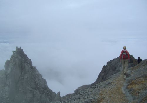
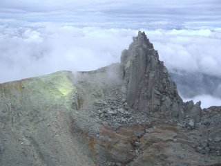
There are two or possibly three peaks up there, depending on how picky you are with peak terminology. We had lunch on the lower one, and then summited the highest one. A path then takes you on to a precipice where you can look down into the twin caldera of Gunung Sinabung. The calderas are guarded by the third peak, a bizarre and forbidding rock that juts straight out against the sky.
We took the more used Lake Kawar path down. This is a slightly steeper path that takes you down through a sulfur-studded lava flow, down into the muddy jungle below. The forest is very pretty, but at this stage we were feeling pretty worked. The descent took a little bit less than two hours.
In total, the climb covers 1000 meters of altitude gain. Since most tourists visiting the area opt instead to climb the easier Gunung Sibayak, we had the mountain pretty much to ourselves. If you’re in the area, it’s definitely the thing to do.
No related posts.
Related posts brought to you by Yet Another Related Posts Plugin.
This entry was posted on Thursday, August 6th, 2009 at 10:56 pm and is filed under Indonesia. You can follow any responses to this entry through the RSS 2.0 feed. You can leave a response, or trackback from your own site.
-
mom
-
mom
-
Sarah
-
Sarah
-
http://www.himachal.biz Sam
-
http://www.thekullumanali.com Veer thakur
-
http://www.himachal.co.uk Ronie thakur
-
http://www.himachalonline.com Robin Thakur


